

As African countries accelerate satellite launches and generate unprecedented volumes of geospatial data, experts are warning that artificial intelligence systems must be developed in tandem with robust legal and governance frameworks — not after the fact.
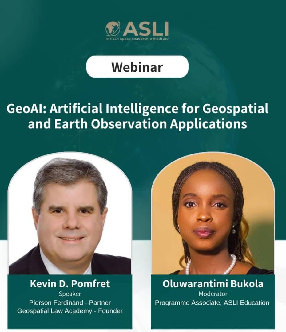
Speaking at a webinar titled “GeoAI: Artificial Intelligence for Geospatial and Earth Observation Applications,” Pomfret Kelvin, Founder of the Geospatial Law Academy, argued that the continent has a unique window of opportunity to build AI systems where governance is embedded from the start rather than retrofitted later. The webinar was moderated by Bukola Oluwarantimi, Programme Associate at ASLI Education.
“I think this is a unique opportunity for the countries in Africa to build an AI system where AI is built along with governance,” Kelvin said. “And it is not going to be an easy thing to do, and it won’t be a perfect thing to do, but it is an opportunity to do that.”
GeoAI — the application of artificial intelligence to geospatial and Earth observation data — is increasingly deployed in disaster warning and early rescue operations, where satellite imagery gives emergency responders real-time clarity on critical situations. The technology also provides farmers with interpreted insights on food security, helps identify illegal environmental activities, and supports city planners in building smart cities.
But as AI takes on greater analytical power at massive scale, Kelvin warned that the legal questions grow progressively more complex across four levels: data collection, model building, output, and decision-making.
At the data collection stage, AI systems engage a range of ownership rights and interests, raising issues of privacy, licensing, and cross-border data transfer. Once data is collected, questions arise about how models are trained and whether specific data types can legally be used for training. The output level matters legally because people increasingly rely on AI-generated conclusions rather than raw maps or datasets — conclusions that may be wrong or may not reflect the accuracy, completeness, or timeliness of the underlying data.
That raises the central question of who is liable — the user, the model builder, or the data provider.
Kelvin noted that combining location data with other datasets can reveal patterns of association and facts, and AI now does this at scale, often as a “black box” where it is impossible to see what data was used, how the model was trained, or how a decision was reached. Lawmakers, he said, are scrambling to respond.
He also emphasized that much of what is called AI governance is really data governance, and that accountability stays with people and organisations — the AI systems themselves are not held accountable.
“There’s a significant overlap between just data governance and AI governance, and then human oversight and accountability is going to be really important,” he said.
For important or life-affecting decisions, Kelvin argued that someone should review the data and output, and people should be able to challenge AI-driven decisions — for example, in banking, insurance, or healthcare — and find out why they were made.
He pointed to a push within the geospatial and AI communities to provide more transparency about what data is used, how models were built, what the accuracy is, where uncertainty lies, and where the risk of going wrong exists.
“If you do not understand the limitations of data in the models, you could do some real harm,” he said. “So, there is this push within the geospatial community, in the AI community, to provide more transparency about what data is used, how the models were built, what the accuracy is, where the uncertainty is, where the risk is of going wrong, and building that into the tools and being transparent for your customers or for your end users so they will know.”
Kelvin cautioned that GeoAI laws are being built in real time and change should be expected — not just through legislation, but through contracts and court cases. He noted that geospatial work is horizontal, spanning sectors such as space, energy, and land rights, while law is vertical, regulating by specific data or use. Building a GeoAI tool that serves many applications requires understanding the legal framework of each sector where it will be used.
He also warned that policies and risk inventories cannot be developed once and shelved.
“You can’t just build this policy or create this risk inventory and then just put it on the shelf,” he said. “You need to come back and take a look at it because six months from now, certainly a year from now, that may all change because the model that you built your application on may have increased exponentially, both for good and for bad.”
During the discussion, participants raised concerns about how African countries can build capacity to assess compliance and prevent data misuse. Kelvin acknowledged a wide gap between the legal and technology sectors, noting that few lawyers understand technology and few technologists understand the law. He encouraged geospatial professionals to engage their legal colleagues, and participants agreed that capacity building — including professional certification in data protection law and encouraging space lawyers to move into geospatial data law — is the foundation for effective safeguards.
On the question of whether data protection rules slow innovation, Kelvin confirmed that technology companies commonly make this argument, claiming restrictions undercut products that save lives, improve education, or raise crop yields. He noted the argument has largely prevailed in the US, which still lacks a comprehensive data protection law, and expects it to continue worldwide.
Regarding the balance between public benefit and privacy risk, Kelvin said there is no single answer, but decision-makers should ask what the application is for, what rights people are being asked to give up, how the data will be used, and how this will be enforced. Trust in technology, he added, should rest on legal and policy frameworks rather than on faith in companies.
“We are still trying to figure out what is a complete data set for a lot of these new applications that are being built,” Kelvin said. “And so, thinking about who’s responsible and how you allocate that from a legal standpoint is going to be really interesting and challenging for GeoAI.”
The webinar brought together geospatial professionals, legal experts, policymakers, and technology stakeholders to explore the intersection of GeoAI, law, and governance as Africa expands its satellite and data capabilities.